Categories
Mandal

Amruthalur Mandal

Amruthalur mandal is located in Guntur district of Andhra Pradesh, India(Bharat). Amruthalur mandal  is the part of capital region development authority(CRDA).It is 39 km far from the Guntur city and 53 Km far from VijayawadaThe Mandal boundaries are Tsundur Mandal, Tenali Mandal, Vemur Mandal, Cherukupalli Mandal, Ponnur Mandal and Pittalavanipalem Mandal

Mandal(SubDistrict)Amruthalur
DistrictGuntur
stateAndhra Pradesh
CountryIndia(bharat)
Number of Villages13
Population44,713
LanguageTelugu
TimeZoneUTC/GMT +5:30, IST

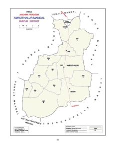
Amruthalur Mandal Map

Amruthalur Mandal

Villages  in Amruthalur Mandal

Name of the VillageAreaHouseHoldsPopulationPincode
Amruthalur1,4991833 6,524522325
Bodapadu3504751,423522341
Govada1,650 3982055522341
Intur 2,18416765715522341
Koru514 215757522312
Kuchipudi107519036788522313
Moparru8779723324522312
Mulpur1,29215585,387522261
Panchalavaram9145291,848522325
Peddapudi5809353,395522325
Pyaparru4338172,465522341
Thurumella4853981,422522312
Yelavarru5806252,055522341

Demographics

As per the census of 2011, there were 15068 households residing in the Amruthalur mandal. The total population of the Amruthalur mandal is 58,447. The Amruthalur mandal has 27,585 literates.There were 37871 voters in Amruthalur mandal.


Name of the VillageTotal PopulationMale PopulationFemale Population0-6 Yr Total Population 0-6 Yr Male Population 0-6 Yr Female Population Total VotersMale VotersFemale Voters 
Amruthalur6,524 3,297 3,227477 237 2405440 2670 2769
Bodapadu1,423 726697117 67 501256 613643
Govada3,610 1,757 1,853245 122 1233051 1478 1573
Intur5,715 2,919 2,796482 251 2314694 2250 2444
Koru757
373 38455
28 27650 327323
Kuchipudi6788

3299 3489619

2903293844
1867 1977
Moparru3324


1666 1658263


145 1182728 1349 1379
Mulpur5,387 2,679 2,679490 255 2351590 776 814
Panchalavaram1,848 924 92416684 821002 341661
Peddapudi3,395
1,710 1,685333 185 1482739 1338 1401
Pyaparru2,465
1,216 1,24994
75 1691906 760 1146
Thurumella1,422
646 776 99
52 471303 618 685
Yelavarru2,055 1,021 1,034180 102 781573 769 804

Education

Name of the VillageNumber of SchoolsNumber of Colleges 6-14 Yr ChildrenTotal LiteratesMale LiteratesFemale LiteratesTotal IlliteratesMale IlliteratesFemale IlliteratesLiteracy RateIlliteracy Rate  
Amruthalur8NA5474,483 2,447 2,0362,041 850 1,19168.7131.28
Bodapadu3NA143978 549 429445 177 26868.7231.27
Govada3NA3392,352 1,205 1,1471,258 706 55265.1534.84
Intur7NA5643,993 1,929 2,0641,72 2990 73269.8630.13
Koru1NA63536
281255221
92 12970.8029.19
Kuchipudi6NA6014310

2277 20332478

1022 145663.4936.50
Moparru5NA4052304
1219 10851020
447 57369.3130.68
Mulpur6NA6573,553 1,845 1,7081,834 834 1,00065.9534.04
Panchalavaram2NA2021,191 641550657 283 37464.4435.55
Peddapudi4NA4232,209 1,192 1,0171,186 51866865.0634.93
Pyaparru4NA252852 741 1,593364 508 87234.5614.76
Thurumella3NA197998462 536424 184 24070.1829.81
Yelavarru3NA2261,301 706 595754 32842663.3036.69


Administration

Amruthalur Mandal comes under Bapatla parliament constituency and Vemuru assembly constituency

In the year 2014 Elections Malyadri Sriram elected as the member of parliament(MP) and Ananda Babu Nakka  elected as the member of legislative assembly(MLA)

Agriculture

As per 2001 census,

Name of the VillageArea in HectaresNumber of forest landTotal irrigated areaUnirrigated areaCulturable wasteArea not available for cultivationTotal milk production in the GP (litres in a year)Total egg production (number) 
Amruthalur1,4990.001299.000.000.00200.0034855232340
Bodapadu3500.00275.000.000.00 75.0046554017520
Govada1,650 0.001458.000.000.000.0089867012600
Intur 2,1840.001913.000.000.00271.001557287 47580
Koru514 0.00465.000.000.0048.54 46554017520
Kuchipudi10750.00872.0027.000.00176.0023484057060
Moparru8770.00800.000.000.0077.0022495530150
Mulpur1,2920.001241.000.000.0051.00 404955 42000
Panchalavaram9140.00833.000.000.0081.00 13818511340
Peddapudi5800.00503.000.000.0077.0022495530150
Pyaparru4330.00361.000.0064.008.00 32490038360
Thurumella4850.00399.000.000.0086.0022124442630
Yelavarru5800.00503.00 0.000.0076.0019992327450

How To Reach

Name of the VillageTenaliAmruthalurGunturVijayawadaHow to reach
Amruthalur16.239.2 km52.9
Bodapadu23.712.035.660.4
Govada21.24.242.557.9
Intur22.610.640.754.9
Koru14.65.933.951.3
Kuchipudi7.67.234.944.8
Moparru17.86.133.254.5
Mulpur11.46.738.248.1
Panchalavaram203.842.356.7
Peddapudi12.83.633.249.5
Pyaparru20.48.736.657.2
Thurumella16.03.835.452.2
Yelavarru19.34.340.670.2

Geography 

 latitude: 16.779027

longitude: 80.124906

Temperature: 36  C/F

Wind: 21 Km/h

Tourism

The nearest tourist places are Amaravathi, Guntur, Vijayawada, Mangalagiri and NagarjunaKonda.

The distance from Amruthalur Mandal to Amaravathi is 40.6 Km

and the distance from the Amruthalur Mandal to Nagarjuna Konda is 177 KM

Map

Categories
Mandal

Mangalagiri Mandal

Mangalagiri mandal is located in Guntur district of Andhra Pradesh, India. Mangalagiri Mandal  is the part of capital region development authority(CRDA).It is 24.9 km far from the Guntur and 14.9 far from the Vijayawada.The Mandal boundaries are Pedakakani Mandal, Duggirala Mandal, Thadepalli Mandal,Tadikonda Mandal and Thullur Mandal

Mandal(SubDistrict)Mangalagiri
DistrictGuntur
stateAndhra Pradesh
CountryIndia(bharat)
Number Of Villages11
Number of Towns1
Population136,264
LanguageTelugu
TimeZoneUTC/GMT +5:30, IST

Mangalagiri Mandal Map

Mangalagiri


Villages and Towns  in Mangalagiri Mandal

Name of the VillageAreaHouseHoldsPopulationPincode
Atmakur95514476103522503
Chinakakani1083 16947,040 522508
Chinavadlapudi1042128 433522437
Kaza1818249010,148 522508
Krishnayapalem6344711,560 522502
Kuragallu1434 1232 4340522502
MangalagiriNA28139107,197 522503
Nidamarru1,13116986196522502
Nowlur2091 NANA522233
Nuthakki1,122 40599512522303
Pedavadlapudi949365513076522302
Ramachandrapuram9183711077522303

Demographics

As per the census of 2011, there were 65,356 households residing in the Mangalagiri Mandal.The total population of Mangalagiri  Mandal is 1,36,264. The Mangalagiri Mandal has 33,512 literates.There were 59506 voters in Mangalagiri Mandal.


Name of the VillageTotal PopulationMale PopulationFemale Population0-6 Yr Total Population 0-6 Yr Male Population 0-6 Yr Female Population Total VotersMale VotersFemale Voters 
Atmakur6103 3094 3,009NANANA6388 3166 3222
Chinakakani7,040 3,561 3,479748
389 3594501 2240 2261
Chinavadlapudi433216 21736 23 13321 159 162
Kaza10,148 5,708 4,440955 485 4706027 29703057
Krishnayapalem1,560 724 83614678 681182 562620
Kuragallu4,340 2,156 2,184430 222 2082033 9921041
Mangalagiri107,197 53,301 53,89611,176 5,640 5,53668073 26519 27533
Nidamarru6,196 3,032 3,164567266 3014614 23182296
NowlurNANANANANANA1770 899871
Nuthakki9,512 4,839
4,673624315 3097051 3424 3626
Pedavadlapudi13,076 6,552 6,5241,090 535 5559791 4787 5004
Ramachandrapuram1,077 516 56161 37 24797 383 414

Education

Name of the VillageNumber of SchoolsNumber of Colleges 6-14 Yr ChildrenTotal LiteratesMale LiteratesFemale LiteratesTotal IlliteratesMale IlliteratesFemale IlliteratesLitercay RateIlliteracy Rate
Atmakur5NA1114NANANANANANANANA
Chinakakani3NA6424,384 2,360 2,0242,656 1,201 1,45562.2737.73
ChinavadlapudiNANA29331 16017110256 4676.4423.56
Kaza4NA7186,349 4,003 2,3463,799 1,705 2,09462.5637.44
Krishnayapalem1NA249983484499577 240 33763.0136.99
Kuragallu2NA2022,359 1,337 1,0221,981 819 1,16254.3545.65
MangalagiriNAANANA70,967 38,292 32,67536,230 15,009 21,22166.2033.80
Nidamarru4NA11143,5851,962 1,6232,611 1,070 1,54157.8542.14
Nowlur4NA389NANANANANANANANA
Nuthakki4NA8426,264 3,362 2,9022,972 1,235 1,73765.8531.24
Pedavadlapudi10NA29148,585 4,6523,9334,491 1,900 2,59165.6534.35
RamachandrapuramNANA81672 342 330405 174 23162.3937.60


Administration

Mangalagiri Mandal comes under Guntur parliament constituency and Mangalagiri assembly constituency

In the year 2014 Elections Galla Jaydev elected as the member of parliament(MP) and
Alla Rama Krishna Reddy elected as the member of legislative assembly(MLA).

Agriculture

As per 2001 census,

Name of the VillageArea in HectaresNumber of forest landTotal irrigated areaUnirrigated areaCulturable wasteArea not available for cultivationTotal milk production in the GP (litres in a year)Total egg production (number) 
Atmakur955NA418.44128.29200.00208.00150000010000
Chinakakani1083 0.00524.47274.50 0.00284.007300001800
Chinavadlapudi1042NA159.04469.00 398.1815.78144000300
Kaza18180.00753.93392.55300.00371.006570002760
Krishnayapalem6340.00353.7022.260.00258.0427375012000
Kuragallu1434 0.00222.58655.00300.00
256.00120000 810
MangalagiriNANANANANANANANA
Nidamarru1,1310.0082.15706.58200.00142.00 17520010800
Nowlur2091 NA590.84590.00NA 910.00590.841200
Nuthakki1,122 171.99750.29105.220.0094.5012634000
10800
Pedavadlapudi9490.00794.0017.000.00138.001053000 49185
Ramachandrapuram9180.00747.46100.0048.2822.267812002800

How To Reach

Name of the VillageMangalagiriGunturVijayawadaHow to reach
Atmakur2.926.412.8
Chinakakani3.921.317.8
Chinavadlapudi8.031.418.7
Kaza6.219.218.9
Krishnayapalem7.531.914.0
Kuragallu7.629.321.3
Mangalagiri24.914.9
Nidamarru5.428.622.5
Nowlur5.031.623.6
Nuthakki10.033.014.0
Pedavadlapudi6.529.917.2
Ramachandrapuram12.936.417.9

Geography

 latitude: 16.779027

longitude: 80.124906

Temperature: 36  C/F

Wind: 21 Km/h

Economy

Name of the VillageTotal income (in Rs.'00)Total expenditure (in Rs.'00)
Atmakur953100904400
Chinakakani780174624955
Chinavadlapudi4103141576
Kaza1103659 1131273
Krishnayapalem208307186301
Kuragallu266756395028
Mangalagiri2686624614056234
Nidamarru284188244437
Nowlur19354421935442
NuthakkiNANA
Pedavadlapudi13472751253164
Ramachandrapuram284188244437

Tourism

Mangalagiri is one of the tourist place in Mangalagiri Mandal.

The nearest tourist places are Guntur,Vijayawada,Amaravathi and NagarjunaKonda.

The distance from the Mangalagiri Mandal to Nagarjuna Konda is 120 KM


Map


Categories
Mandal

Amaravathi Mandal

Amaravathi mandal is located in Guntur district of Andhra Pradesh, India. Amaravathi Mandal  is the part of capital region development authority(CRDA).It is 32 km far from the Guntur and 40 Km far from the Vijayawada.The Mandal boundaries are Krishna River, Krosuru Mandal, Pedakurapadu Mandal, Tadikonda Mandal and Thullur Mandal.

Mandal(SubDistrict)Amaravathi
DistrictGuntur
stateAndhra Pradesh
CountryIndia(bharat)
Number Of Villages17
Population66,277
LanguageTelugu
TimeZoneUTC/GMT +5:30, IST

Amaravathi Mandal Map

Amaravathi Mandal


Villages  in Amaravathi Mandal

Name of the VillageAreaHouseHoldsPopulationPincode
Amaravathi1,1703316 13,400522020
Attalur1,5241188 4783522436
Dharanikota3,5481966 7,534 522020
Didugu2,3529203,152 522402
Endroy8777482703522016
Jupudi4635602,422522436
Karlapudi1,19315805,644522016
Lingapuram58210404,064522436
Malladi5726942,582522436
Munugodu1,94610114,011522402
Narukullapadu9417262,335522436
Nemalikallu1,43915966,111 522016
Pedda Madduru4644021400522020
Pondugala758144541522020
PuttipaduNANANANA
Unguturu1,033739 2768522016
Vykuntapuram1,3608723,126522020

Demographics

As per the census of 2011, there were 17502 households residing in the Amaravathi Mandal. The total population of the Amaravathi Mandal is 66,277. The Amaravathi Mandal has 37,507 literates.There were 48600 voters in Amaravathi Mandal.


Name of the VillageTotal PopulationMale PopulationFemale Population0-6 Yr Total Population 0-6 Yr Male Population 0-6 Yr Female Population Total VotersMale VotersFemale Voters 
Amaravathi13,4006,4326,9681,321647674988648695017
Attalur478324062377499 2482513687 1867 1820
Dharanikota7,534 3,734 3,800725
368 3575242 2428 2814
Didugu3,1521,580 1,572336 182 1542216 1140 1076
Endroy2,677 1,338 1,339263 127 1361988 1027961
Jupudi2,422 1,226 1,196310 163 1471743 866877
Karlapudi5,644 2,847 2,797573 2962774418 2211 2207
Lingapuram4,0642,006 2,058480 2452352205 11281077
Malladi2,582 1,247 1,335289 144 1451960 1004 956
Munugodu4,0111,995 2,016481244 2372773 1373 1400
Narukullapadu2,3351,127 1,208238 105 1331763 863 900
Nemalikallu6,111 3,035 3,076NANANA2773 13731400
Pedda Madduru1,400 699 701146 61 851171 593578
Pondugala541 259 28261 27 34330172 158
PuttipaduNANANANANANANANANA
Unguturu2,768 1,369 1,399278 1461322514 1275 1239
Vykuntapuram3,126 1,578 1,548356 186 1702514 1275 1239

Education

Name of the VillageNumber of SchoolsNumber of Colleges 6-14 Yr ChildrenTotal LiteratesMale LiteratesFemale LiteratesTotal IlliteratesMale IlliteratesFemale IlliteratesLitercay RateIlliteracy Rate
Amaravathi8NA17898,617 4,527 4,0904,783 1,905 2,87864.3135.69
Attalur4NA4972657
1536 11212126 870 125655.5544.45
Dharanikota4114064,498 2,551 1,9473,036 1,183 1,85359.7040.30
Didugu2NA2891,512 8466661,640 734 90647.9752.03
Endroy2NA2001,525 836689 1,178 522 65656.9744.00
Jupudi3NA2891,222 7015211,200 52567550.4549.55
Karlapudi2NA2393,165 1,869 1,2962,479 978 1,50156.0843.92
Lingapuram4NA2942,041 1,161 8802,023 8451,17850.2249.78
Malladi6NA5691,372 7716011,210 47673453.1446.86
Munugodu3NA6382,115 1,193 9221,896 802 1,09452.7347.27
Narukullapadu1NA3121,287 7055821,048 422 62655.1244.88
Nemalikallu3NA331NANANANANANANANA
Pedda Madduru1NA174794 439 355606 260 34656.7143.29
PondugalaNANANA270 145 125271 114 15749.9150.09
PuttipaduNANANANANANANANANANANA
Unguturu2NA2401,571 854 7171,197 51568256.7643.24
Vykuntapuram2NA3281,619 9326871,507 646 86151.7948.21


Administration

Amaravathi Mandal comes under Narasaraopeta parliament constituency and Pedakurapadu assembly constituency

In the year 2014 Elections Rayapati Sambasiva Rao elected as the member of parliament(MP) and Kommalapati Sreedhar elected as the member of legislative assembly(MLA)

Agriculture

As per 2001 census,

Name of the VillageArea in HectaresNumber of forest landTotal irrigated areaUnirrigated areaCulturable wasteArea not available for cultivationTotal milk production in the GP (litres in a year)Total egg production (number) 
Amaravathi1,1700.00159.00588.00125.00298.004750005510000
Attalur1,5240.00244.001026.00208.0046.006400001458
Dharanikota3,5480.0060.002006.00141.001341.003253203169105
Didugu2,3520.0011.001351.00307.00683.004587843810
Endroy8770.00153.00495.00176.0053.001200057500
Jupudi4630.0038.00394.006.0025.00270000827070
Karlapudi1,193167.0051.00819.0089.0067.00471100536
Lingapuram5820.0078.00451.0017.0036.00380216580
Malladi5720.004.00560.005.003.00480600137500
Munugodu1,9460.00134.001215.0041.00556.004860005400
Narukullapadu9410.0087.00529.00282.0043.007740008385
Nemalikallu1,4390.00121.00663.00387.00268.00690023750
Pedda Madduru46458.0073.00284.0048.001.00215205420
Pondugala7580.007.00248.00187.00316.00NANA
PuttipaduNANANANANANANANA
Unguturu1,0330.0084.00671.00201.0077.00172800
9000
Vykuntapuram1,360263.00146.00551.00273.00127.006181003205

How To Reach

Name of the VillagePedakurapaduAmaravathiGunturVijayawadaHow to reach
Amaravathi17.4
Attalur7.915.247.454.8
Dharanikota14.52.934.442.4
Didugu14.46.939.246.5
Endroy20.17.52538.6
Jupudi111244.251.6
Karlapudi29.612.722.538.9
Lingapuram12.2637.545.5
Malladi10.642.850.2
Munugodu13.613.946.253.5
Narukullapadu19.34.027.343.0
Nemalikallu13.513.726.947.6
Pedda Madduru23.45.729.534.1
Pondugala18.312.244.551.8
PuttipaduNANANANA
Unguturu16.210.524.944.3
Vykuntapuram26.79.733.430.3

Geography

 latitude: 16.779027

longitude: 80.124906

Temperature: 36  C/F

Wind: 21 Km/h

Tourism

Amaravathi is one of the tourist places in Amaravathi Mandal.

The nearest tourist places are Guntur, Vijayawada, Mangalagiri and NagarjunaKonda.

The distance from the Amaravathi Mandal to Nagarjuna Konda is 120 KM

Map


Categories
Mandal

Atchampeta Mandal

Atchampeta mandal is located in Guntur district of Andhra Pradesh, India. Atchampeta mandal  is the part of capital region development authority(CRDA).It is 63.5 km far from the Guntur and 70.9 Km far from the Vijayawada.The Mandal boundaries are Bellamkonda Mandal, Krosuru Mandal, Amaravathi Mandal and Krishna District.

Mandal(SubDistrict)Atchampeta
DistrictGuntur
stateAndhra Pradesh
CountryIndia(bharat)
Number Of Villages18
Population58,447
LanguageTelugu
TimeZoneUTC/GMT +5:30, IST

Atchampeta Mandal Map

Atchampeta Mandal

Villages  in Atchampeta Mandal

Name of the VillageAreaHouseHoldsPopulationPincode
Ambadipudi935239904 522265
Challagariga2883361,490 522409
Chamarru2,720300612,232522409
Chigurupadu1,1357142,706 524421
Chintapalli1,64212504,547 524421
Ginjupalli437253949 522409
Kastala1,6335722,292 522410
Kogantivaripalem561223916522409
Konduru1,03110144,028522410
Konur9298433,301 522410
Madipadu 2183821,533522409
Madipaduseri632196900 522410
Mittapalem8183131,225 522421
Oravakallu1,369NANA522409
Pedapalem6389583,916 522410
Taduvoy4214241,702 522409
Tallacheruvu1,16817526,213 522409
Velpuru2,54212894,690 522410

Demographics

As per the census of 2011, there were 15068 households residing in the Atchampeta mandal. The total population of the Atchampeta mandal is 58,447. The Atchampeta mandal has 27,585 literates.There were 37871 voters in Atchampeta mandal.


Name of the VillageTotal PopulationMale PopulationFemale Population0-6 Yr Total Population 0-6 Yr Male Population 0-6 Yr Female Population Total VotersMale VotersFemale Voters 
Ambadipudi904 441 4631186157684 331353239
Challagariga1,490 736754208 104 1041087551536336
Chamarru12,232 6,456 5,7761,320 684 6368698 4291 44073006
Chigurupadu2,706 1,345 1,361 302 149 1532166 10801086714
Chintapalli4,547 2,272 2,275 501 243 2581513 779 7341250
Ginjupalli949 470 47914171 70648 319329253
Kastala2,292 1,153 1,139309 149 1601567 802765572
Kogantivaripalem916 4774391085850678 336 342223
Konduru4,028 1,998 2,030597 284 3133066 1560 15061014
Konur3,301 1,680 1,621438240 1982375 1177 1198843
Madipadu 1,533789 744170 91 791732 879 853382
Madipaduseri900 469 43111156 55NANANA196
Mittapalem1,225 611 614189 9990852 409 443313
OravakalluNANANANANANA1029501 528NA
Pedapalem3,916 1,987 1,929431 229 202316115921569958
Taduvoy1,702 855 847231124 1071166 593 573424
Tallacheruvu6,213 3,151 3,062600 3212793805 1865 19401752
Velpuru4,690 2,341 2,349430 235 1953644 1817 18271289

Education

Name of the VillageNumber of SchoolsNumber of Colleges 6-14 Yr ChildrenTotal LiteratesMale LiteratesFemale LiteratesTotal IlliteratesMale IlliteratesFemale IlliteratesLitercay RateIlliteracy Rate
Ambadipudi1NA59399 231 168505 210 29544.1455.86
Challagariga2NA188636 375 261854361 49342.6857.32
ChamarruNANANA6,848 4,170 2,6785,384 2,286 3,09855.9844.02
Chigurupadu4NA4511,160 712 4481,546 633 91342.8757.13
Chintapalli2NA2302,128 1,311 817 2,419 9611,45846.8053.20
GinjupalliNANANA329 207 122620 26335734.6765.33
Kastala2NA3891,0666224441,226 531 69546.5153.49
Kogantivaripalem1NA60492 274218424 20322153.7146.29
Konduru6NA5681,264 803 4612,764 1,195 1,56931.3868.62
Konur2NA4331,394 818 5761,907 862 1,04542.2357.77
Madipadu 2NA280796 478 318737 311 42651.9248.08
MadipaduseriNANANA389244 145511 225 28643.2256.78
Mittapalem1NA130455265 190770 34642437.1462.86
Oravakallu1NA125NANANANANANANANA
Pedapalem5NA4481,821 1,041 7802,095 946 1,14946.5053.50
Taduvoy4NA239726 428 298976 427 54942.6657.34
Tallacheruvu5NA6293,127 1,786 1,3413,086 1,365 1,72150.3349.67
Velpuru4NA6382,310 1,284 1,0262,380 1,057 1,32349.2550.75


Administration

Atchampeta Mandal comes under Narasaraopeta parliament constituency and Pedakurapadu assembly constituency
In the year 2014 Elections Rayapati Sambasiva Rao  elected as the member of parliament(MP) and Kommalapati Sreedhar elected as the member of legislative assembly(MLA)

Agriculture

As per 2001 census,

Name of the VillageArea in HectaresNumber of forest landTotal irrigated areaUnirrigated areaCulturable wasteArea not available for cultivationTotal milk production in the GP (litres in a year)Total egg production (number) 
Ambadipudi9350.0077.00842.000.0016.001153008208
Challagariga28862.0020.00185.000.0021.0026168420784
Chamarru2,7200.00460.00594.00531.001135.00NANA
Chigurupadu1,1350.0071.00933.000.00131.0049157416008
Chintapalli1,6421186.002.00416.000.0038.00466422
21768
Ginjupalli437162.000.00257.000.0018.00NANA
Kastala1,6330.0055.00500.000.001078.0021266412768
Kogantivaripalem5610.004.00322.000.00235.00120NA
Konduru1,031421.00362.00248.000.000.00113423442504
Konur9290.0012.00449.000.00468.00NANA
Madipadu 2180.000.00198.000.0020.0093327660744
Madipaduseri632162.000.00229.0011.00229.00NANA
Mittapalem81882.00215.00346.000.00175.001919466384
Oravakallu1,3690.0046.00633.000.00690.008544150624
Pedapalem6380.00256.00303.000.0079.0057375030384
Taduvoy4210.5614.00191.0040.00175.0073422621528
Tallacheruvu1,16881.0051.00986.0029.0021.0048607835184
Velpuru2,5420.0087.001192.000.001263.0066055227456

How To Reach

Name of the VillageAtchampetaGunturVijayawadaHow to reach
Ambadipudi16.660.067.4
Challagariga18.781.890.8
Chamarru750M63.972.9
Chigurupadu3.161.568.9
Chintapalli8.872.080.9
Ginjupalli22.185.384.9
Kastala13.355.763.0
Kogantivaripalem6.153.768.3
Konduru21.764.177.6
Konur10.4 56.864.2
Madipadu 28.590.692.9
Madipaduseri23.4 95.593.6
Mittapalem 23.065.279.2
OravakalluNANANA
Pedapalem5.5 59.571.8
Taduvoy14.476.586.5
Tallacheruvu 5.2 67.177.1
Velpuru6.856.169.1

Geography 

 latitude: 16.779027

longitude: 80.124906

Temperature: 36  C/F

Wind: 21 Km/h

Tourism

The nearest tourist places are Amaravathi, Guntur, Vijayawada, Mangalagiri and NagarjunaKonda.

The distance from Atchampeta Mandal to Amaravathi is 31.2 Km

and the distance from the Atchampeta Mandal to Nagarjuna Konda is 120 KM

Map